April 30th 2026, by Matt Rabagliati

Matthew Rabagliati, UKNC lead for the Climate Change and UNESCO Heritage Project, reflects on the process and key findings from the 18-month project, and introduces the FutureScapes resources created to support place-based climate action, collaboration and innovation.

Introduction to guide

This guide introduces FutureScapes: the methodology, tools and learning developed through the UKNC-DCMS Climate Change and UNESCO Heritage Project. It explains why we focused on UNESCO sites as platforms for place-based climate action, what we tested with three pilot sites, and how the resources can support others facing similar challenges.

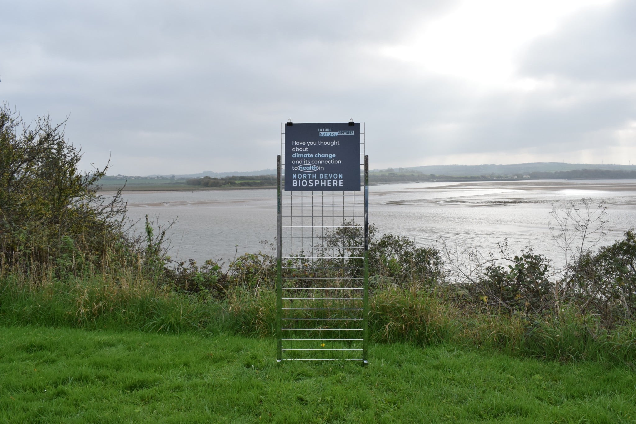
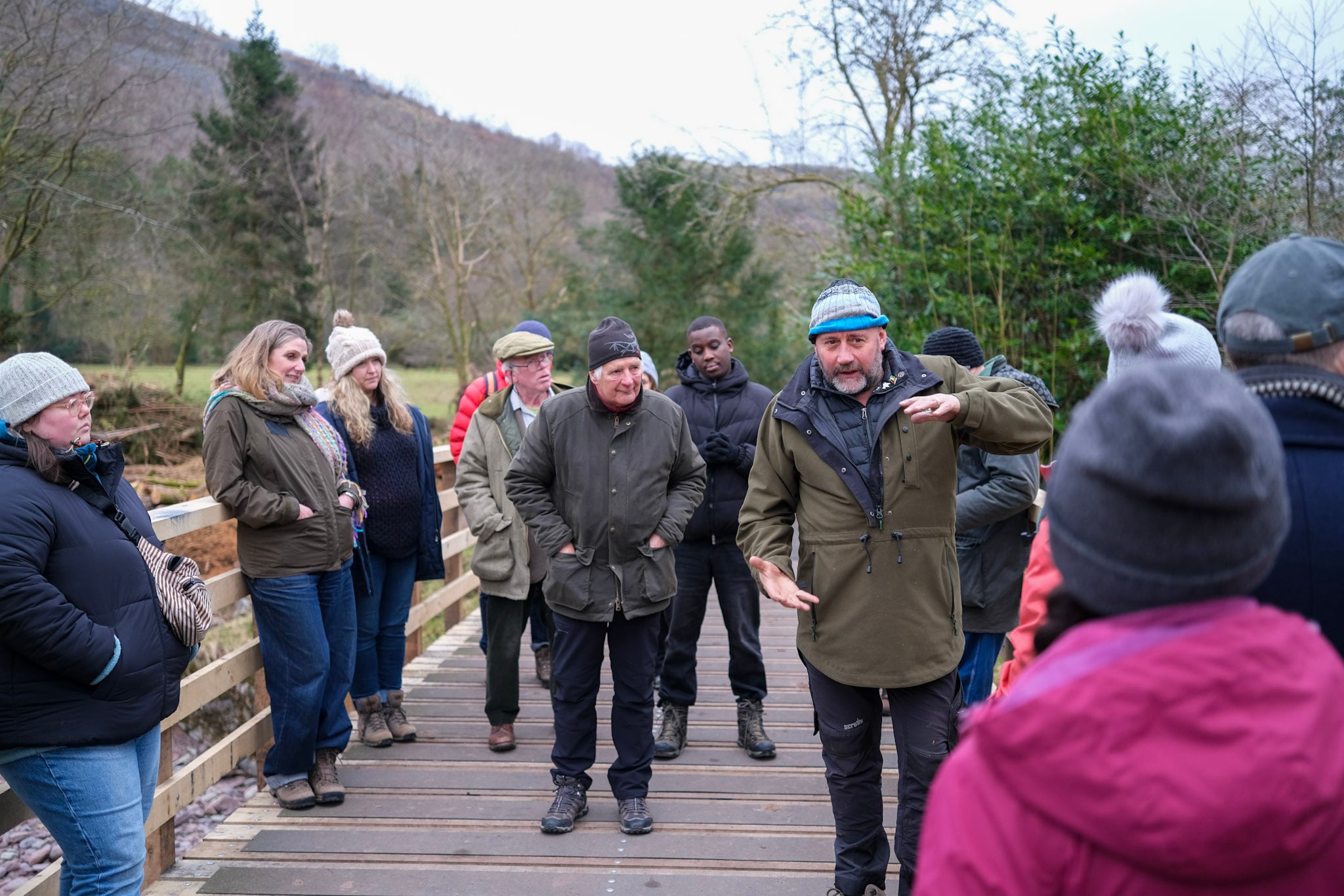
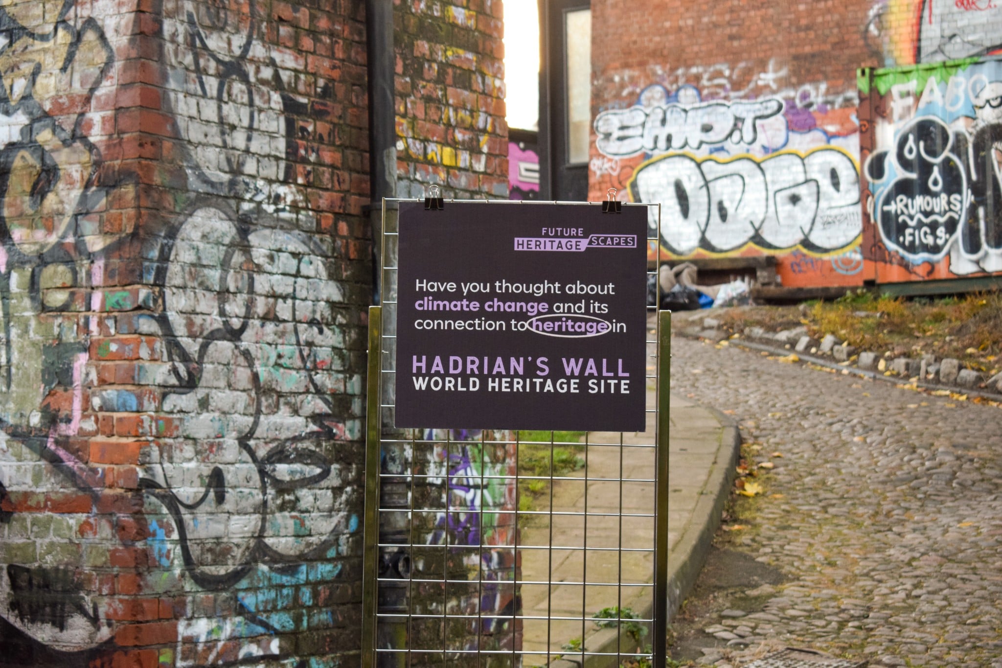
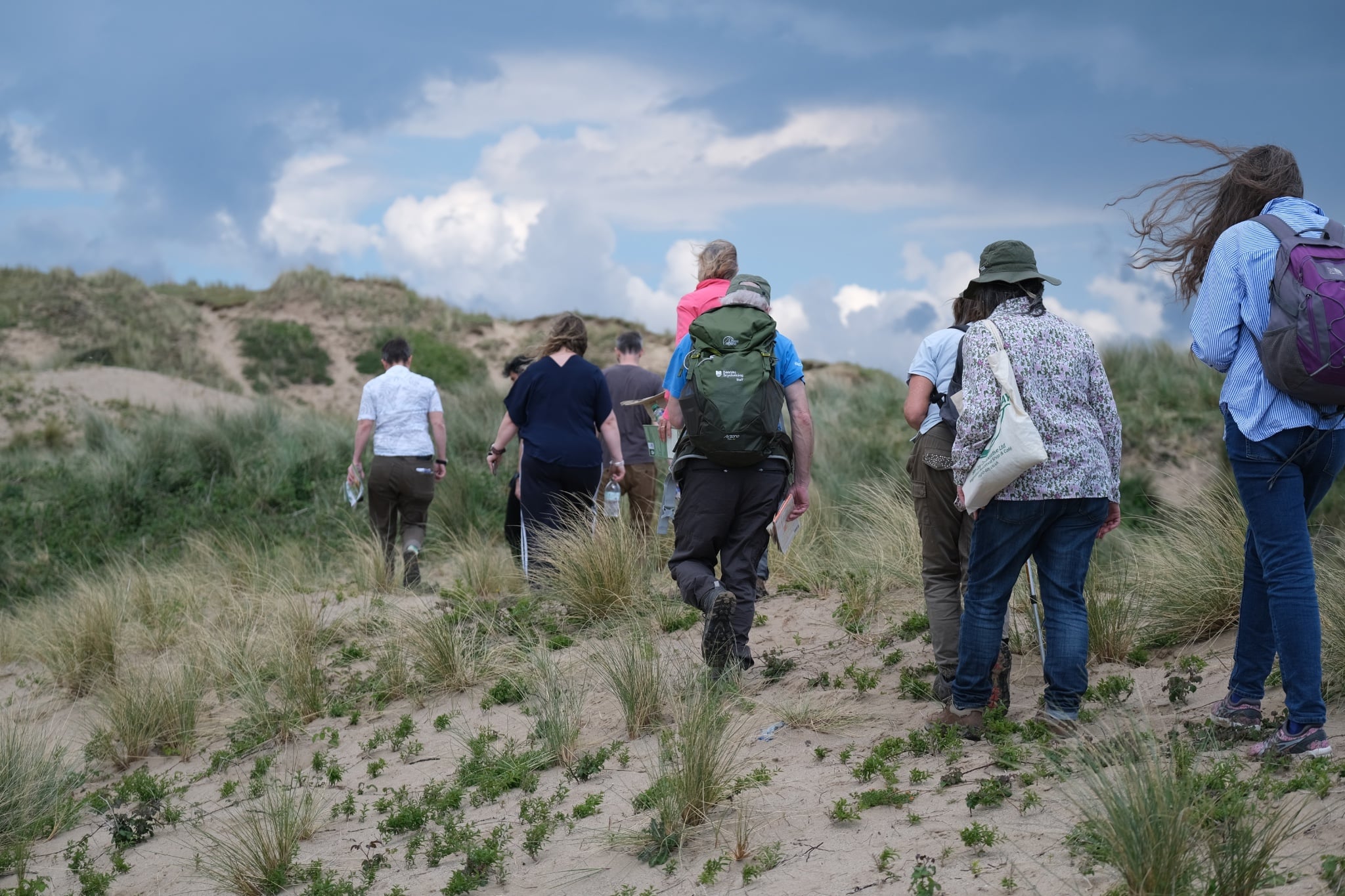
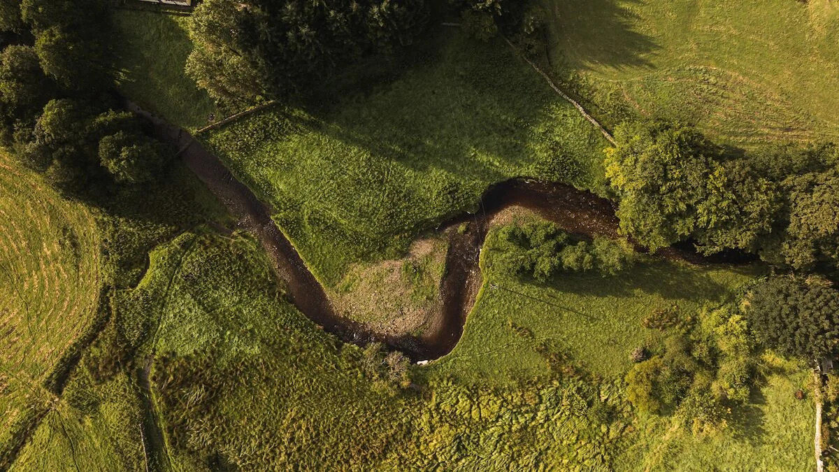
The project worked with Fforest Fawr UNESCO Global Geopark, Hadrian’s Wall UNESCO World Heritage Site and North Devon UNESCO Biosphere Reserve to explore a practical question: how can heritage, data and collaboration help places respond more effectively to climate change and other complex challenges?

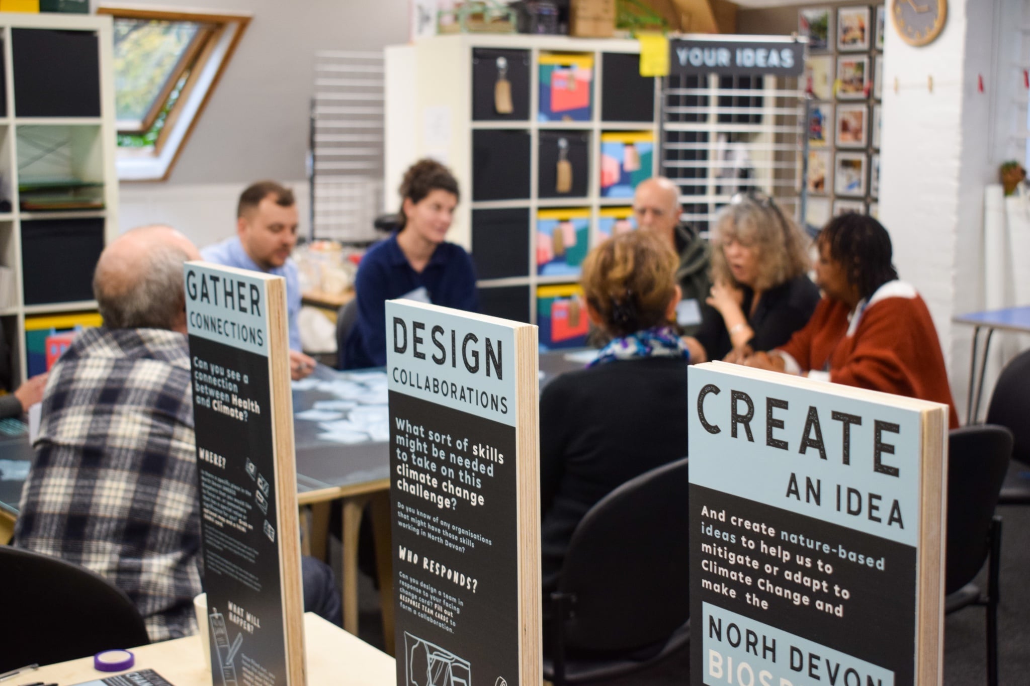
One of the key answers is not simply better data, better conservation or better technology, though all three matter. The central lesson from the project is that places need better ways of working relationally across boundaries - between sectors, institutions, communities, knowledge systems and scales of decision-making.

Across the world, places are being reshaped by interconnected pressures: climate change, biodiversity loss, changing land use, economic transition, technological disruption, demographic shifts and the erosion of cultural traditions. These pressures do not happen separately. They interact within real landscapes, communities and local economies.

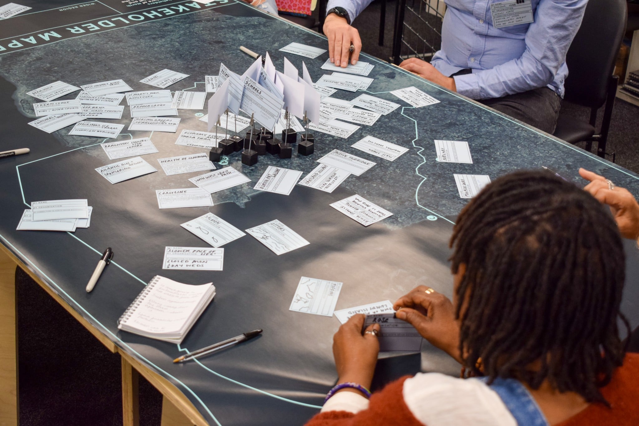
FutureScapes starts with this idea: places are not composed of isolated assets or issues. They are living systems of natural, cultural, social and economic relationships. Responding to the challenges they face requires ways of understanding how pressures connect, how decisions in one part of a system affect another, and how organisations and communities can work together over time.

In this sense, FutureScapes is not only a climate or heritage project. It reflects a wider form of social innovation: developing new ways for people, organisations and communities to work together around complex, place-based challenges. Its value lies not only in digital tools and datasets, but also in changing how knowledge is shared, how decisions are made, and how collective capacity is built over time.

What FutureScapes provides

FutureScapes provides a practical framework and toolkit for place-based climate action and collaboration. It helps places:

  • map stakeholders and understand whose voices may be missing;
  • map data and identify what knowledge exists, where it is held and how it can be used;
  • assess threats and opportunities across landscapes, sectors and communities;
  • develop collaborative ways of working that connect local priorities with planning, research and action.

This guide introduces key resources available through FutureScapes. It is structured around four stages of the FutureScapes process:

  1. Stakeholder Mapping
  2. Data Mapping
  3. Threat and opportunities assessment
  4. Collaborative Working

While this guide cannot capture the full range of resources available on the platform, it aims to provide a starting point for policymakers, UNESCO site coordinators, researchers and community partners interested in applying these approaches within their own landscapes.


1. Stakeholder Mapping

Before data could be brought together or shared challenges understood, the project began by asking a basic but important question: who is involved in shaping the future of these places, and who is missing from the conversation?

To explore this, the project commissioned Lateral North to conduct design-led stakeholder mapping and engagement across the three pilot UNESCO sites and at the governmental level. Rather than treating stakeholder mapping as a static exercise, the work used workshops and local engagement activities to explore how communities, organisations and practitioners understood climate change in relation to their own places, culture and heritage.

The process produced relational maps of stakeholders across the three sites, categorised stakeholder lists that could feed into a Customer Relationship Management system, and site-specific recommendations for future engagement.

This work also led to the creation of a reusable FutureScapes engagement toolkit, designed to help sites and partners run workshops around three questions: where change is happening, who needs to be involved, and how collaboration can begin. The toolkit is rooted in the idea that complex climate and heritage challenges require collective action, shaped and sustained by local partners and communities.

Importantly, stakeholder mapping in the project did not stop at formal organisations. It also opened up more creative and participatory ways of identifying relationships, perspectives and possible futures.

Spotlight

  • One of the main insights from this stage of the project was that traditional stakeholder mapping, while useful, could not fully capture the complexity of UNESCO sites’ operations. As Anna Spencer’s Liveable Futures report argues, UNESCO sites are not simple maps of organisations and influence. They are shaped by relationships, histories, ecosystems, communities and cultural meanings.

    To explore this further, the project commissioned Anna to go beyond conventional mapping and use a situational analysis approach. This involved looking not only at stakeholders but also at social arenas, spheres of influence, marginal perspectives, and more-than-human actors, including rivers, ecosystems, species, and histories that shape and are shaped by human action.

    The report argues that these wider dimensions, and alternative ways of understanding place, must complement more conventional, data-driven approaches if climate action is to become genuinely adaptive, inclusive and regenerative.

    This broader perspective matters because it shifts the emphasis from simply identifying institutions to understanding the deeper conditions that enable or constrain collective action. It also points to a tension that runs through the wider project: the need not only for better data, but for better stories, stronger convening capacity, and richer ways of understanding and responding to place.

    In that sense, stakeholder mapping became more than a diagnostic exercise. It became an intervention in its own right, helping to surface new relationships, overlooked voices and more imaginative ways of responding to climate change.

2. Data Mapping

One of the most consistent findings from the project was that the challenge facing many places is not necessarily a lack of data, but a lack of shared infrastructure for collectively using that data.

Across UNESCO sites, large volumes of information already exist on climate change, biodiversity, land use, cultural heritage, infrastructure, tourism and local communities. However, these datasets are often held by different organisations, stored in different formats, and managed through systems that are not designed to work together.

This fragmentation makes it difficult to develop a shared understanding of place-based challenges or to coordinate responses across institutions. To explore how these barriers might be addressed, the project partnered with NIAXO, a specialist data consultancy, to undertake data audits and develop practical tools for collaborative data mapping and use.

Five building blocks for place-based data infrastructure

Through its work with the pilot sites, NIAXO identified five open-source components that can help partners organise, share and use data across place-based partnerships. These include:

  • A Data Catalogue: A structured inventory of datasets across multiple organisations, identifying what data exists, who holds it and how it can be accessed.
  • A CRM system: A Customer Relationship Management system for managing the complex networks of organisations, partners and stakeholders involved in landscape governance.
  • GIS tools: Geographic Information Systems that enable spatial analysis and visualisation of environmental, cultural and infrastructure data across landscapes.
  • A Knowledge Wiki: A shared repository for reports, research, guidance and institutional knowledge that partners can contribute to and access.
  • An Interactive Data Dashboard: A tool allowing users to visualise and explore datasets, identify patterns and support collaborative decision-making.

Many organisations already use one or more of these tools internally. The challenge is that they are rarely integrated across institutions, limiting their potential to support collaborative place-based management. Together, these systems can help form part of the digital infrastructure for more joined-up governance and decision-making.

Mapping the data landscape

To understand how these challenges appear in practice, NIAXO conducted a data audit across the three pilot UNESCO sites. This helped identify the types of data held across organisations and how these datasets are currently used. The audit mapped a wide range of data sources relevant to landscape management, including:

  • environmental monitoring datasets;
  • heritage and conservation records;
  • land-use and planning data;
  • tourism and visitor information;
  • infrastructure and transport data;
  • socio-economic and community indicators.

The project also mapped relevant datasets across UK Government departments and national data infrastructures, recognising that many datasets shaping local landscapes are generated and maintained at national level. This confirmed a central challenge: large volumes of relevant information already exist, but they are distributed across institutions and are not always easy to connect or use collectively. In many cases, organisations were unaware of data held by partners or lacked the governance frameworks and technical capacity required to share it effectively.


3. Threat and Opportunities Assessment

Many of the challenges facing places cannot be understood in isolation. Climate change, biodiversity loss, economic change, demographic pressures, tourism and the erosion of cultural traditions often interact across landscapes, institutions and communities. They also unfold across different timescales, from immediate risks to long-term generational change.

The project explored whether a more systemic understanding of threats and opportunities could help UNESCO sites and their partners identify shared priorities and areas for collaboration.

To do this, the project drew on the World Heritage Convention’s Periodic Reporting framework, which identifies categories of potential pressures affecting cultural and natural heritage. These range from environmental pressures such as flooding, climate change and biodiversity loss, to social and cultural challenges including the loss of traditional knowledge, changing land-use patterns, and pressures from tourism and development.

Rather than treating these as a simple checklist, the project asked UNESCO site coordinators and partners across the UK to review and weight threats and opportunities according to their relevance to their own places and communities. Responses were received from 33 UNESCO designations across the UK, including Biosphere Reserves, Creative Cities, Global Geoparks and World Heritage Sites.

This created a unique dataset, allowing the project to examine how different pressures are experienced across different types of places.

Identifying patterns across landscapes

To analyse the results, the project used cluster analysis, a statistical method that identifies groups within complex datasets based on similarities in responses. This helped reveal which combinations of environmental, social and cultural pressures tend to appear together across different landscapes.

The results showed that UK UNESCO sites can be grouped according to shared configurations of threats and opportunities. Some sites reported strong overlaps between climate impacts, biodiversity loss and land-use change, while others highlighted pressures linked to tourism, urban development or cultural change. Our latest research shows that whether something is perceived as a threat or an opportunity depends not only on external factors, but also on how your partnership is structured, its foundational mission, who is included, and whether it sees its role within a traditional conservation paradigm or within more innovative, socially-driven frameworks.

This matters because it moves heritage risk beyond isolated categories or individual sites. It helps identify where sites may be facing similar challenges and where shared learning, collaboration or coordinated action could be useful.

From assessment to collaborative action

Understanding these patterns is particularly valuable for UNESCO sites, which operate as partnership platforms that bring together multiple organisations across landscapes. By identifying where sites face similar combinations of pressures, the assessment can help reveal potential alliances for collaboration within landscapes and across the wider UNESCO network.

The findings from this analysis have been translated into a shareable threats and opportunities assessment framework, now available through FutureScapes. This resource enables heritage sites and their partners to:

  • assess threats and opportunities within their landscapes;
  • understand how different pressures interact;
  • identify shared challenges across sites;
  • support more coordinated responses to climate and sustainability challenges.

Together, these tools aim to support a shift from isolated site management towards collaborative, place-based responses, helping partners better understand the systemic challenges shaping the future of the places they care for.

4. Collaborative Working

Stakeholder mapping, data mapping and threats and opportunities assessment help build shared understanding. But the ultimate aim of FutureScapes was to explore collaborative action: helping people and organisations work together to respond to complex challenges in real places.

To understand how this could be done in practice, the project partnered with the UCL Climate Action Unit to trial collaborative approaches tailored to each pilot site, including adaptation pathway planning, stakeholder engagement for local planning and Transition Lab-style climate action workshops.

Each site applied the approach differently:

Across the pilots, these processes brought together site managers, local authorities, environmental organisations, researchers, planners, community partners and other stakeholders. They helped participants move from broad concern about climate change to more practical conversations about choices, roles and next steps. The workshops demonstrated how UNESCO sites can act as convening platforms, bringing together organisations that may not normally collaborate to develop shared responses to complex challenges.

Research and innovation partnerships

Alongside the pilot activities, the project established a Research and Innovation Group, chaired by ButCH, bringing together academics, UNESCO Chairs, heritage organisations, site managers, funders and policy specialists from across the UK.

The group helped shape the development of a new UNESCO Climate Action and Sustainability Framework and accompanying Research Agenda, positioning UNESCO-designated sites as living laboratories for climate resilience and sustainability transitions. These publications highlight how UNESCO sites can enable integrated research and action by bringing together:

  • researchers and practitioners;
  • local authorities and communities;
  • cultural and environmental knowledge systems;
  • monitoring infrastructure and open data;
  • national and international policy networks.

Through these partnerships, UNESCO sites can support long-term experimentation and learning, allowing climate solutions to be tested in real-world contexts and shared across wider networks.

From collaboration to innovation

The collaborative model developed through the project is already supporting new partnerships that combine heritage knowledge with emerging technologies.

Along Hadrian’s Wall, the project has supported a new collaboration between the Vindolanda Trust, UKNC and the Kassandra Project, exploring how environmental monitoring, climate modelling and predictive tools can help protect buried archaeology threatened by climate change.

Looking ahead: UNESCO sites as platforms for collaborative futures

The Climate Change and UNESCO Heritage Project has shown that addressing the complex challenges facing places requires more than better protection or better data alone. It requires new ways of working across institutions, sectors and communities.

Through stakeholder mapping, data mapping, threats and opportunities assessment and collaborative working, the project explored how UNESCO sites can support collective learning and innovation. These places already bring together local authorities, environmental agencies, researchers, cultural institutions and community groups. With the right tools, data infrastructure and collaborative processes, they can help partners move from fragmented activity towards shared understanding and coordinated action.

FutureScapes is intended as a practical framework and toolkit to support this work. While the project focused on three UK pilot sites, its lessons are relevant to UNESCO-designated sites and other place-based partnerships worldwide.

By combining place-based partnerships, integrated data approaches and collaborative experimentation, the project has shown how UNESCO sites can contribute to climate resilience and sustainability transitions in the UK and beyond.

Evaluation Report: Climate Change and UNESCO Heritage (CCUH) Project

This document contains the final evaluation of the £1.8m Climate Change & UNESCO Heritage (CCUH) Project, an 18-month Shared Outcomes Fund programme delivered with DCMS.

Supported By
UNESCO in the UK Logo
This website was produced by the UK National Commission for UNESCO as part of its Local to Global programme, made possible with The National Lottery Heritage Fund, thanks to National Lottery players.